
Quick answer
A Moorea snorkeling map divides the island's lagoon into eight primary zones: the Temae reef shelf on the northeast coast, the Opunohu Bay pinnacles, the Hauru Point drop-offs, the Tiahura marine reserve with its stingray sandbar, the Papetoai motu channels, the Ahi Lagoonarium enclosures, the Afareaitu shallow gardens and the Vaiare ferry terminal walls. Each zone offers 2 to 15 meters of visibility depending on tide cycle and wind direction, with the calmest conditions between 08:00 and 11:00 before afternoon trade winds stir sediment.
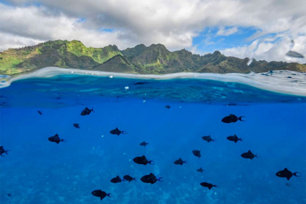
The barrier reef encircling Moorea creates a lagoon system that functions as eight interconnected marine theaters, each defined by its substrate, depth contour and proximity to reef passes. Unlike single-site snorkeling destinations, Moorea requires spatial literacy—the ability to read a map and match conditions to intent. The northwest coast between PK 27 and PK 30 holds the highest density of sites within a four-kilometer stretch, while the eastern and southern coasts remain underdeveloped and current-swept. The Tiahura marine reserve anchors the most-visited quadrant. Established in 2004, the reserve spans 800 hectares from the Intercontinental Resort to the old Club Med jetty, protecting coral bommies, seagrass beds and a population of over 40 southern stingrays. The reserve's centerpiece is a natural sandbar 200 meters offshore where rays congregate in knee-deep water during morning slack tides. Snorkelers enter from the beach at PK 28 or via guided boat departure from the Intercontinental dock. Water depth ranges from 0.5 meters on the sandbar to 4 meters at the bommie fields, with the lagoon floor transitioning from sand to rubble to plating coral as you move seaward. Blacktip reef sharks cruise the channel between the sandbar and outer reef, particularly in the hour before high tide when baitfish compress into the shallows. Temae Beach on the island's northeastern tip offers the opposite profile: a wide reef shelf with minimal boat traffic and strong afternoon wind exposure. The snorkeling zone extends 150 meters offshore before the reef drops into the barrier channel. Green sea turtles forage in the seagrass patches between coral heads, and the site remains accessible to swimmers of all levels due to its gradual depth gradient. The tradeoff is afternoon chop—by 13:00 most days, wind-driven surface waves reduce visibility below 8 meters and make navigation difficult. Locals snorkel Temae before 10:00 or skip it entirely on south-wind days. The Lagoonarium on Motu Ahi operates as a hybrid site: a fenced enclosure stocked with rays, sharks and groupers adjacent to open reef accessible via kayak or outrigger. Admission grants access to both zones, and the open reef section rivals Tiahura in coral density without the crowds. The motu sits 400 meters offshore from the main island, requiring boat transfer. Depth inside the enclosure ranges from 1 to 3 meters; outside the fence the reef slopes to 7 meters before terminating at a sand channel.
“Unlike single-site snorkeling destinations, Moorea requires spatial literacy—the ability to read a map and match conditions to intent.”
Optimal Daily Windows for Your Moorea Snorkeling Map
The best arrival window is 08:00–11:00, as morning conditions provide the calmest water and highest visibility before afternoon winds begin. Prioritizing these hours on your snorkeling map ensures the most stable environment for observing lagoon marine life.
May to October
Moderate crowdsDry season, 24°C–28°C. Lower humidity and cooler breeze.
This period offers the most consistent sunshine and visibility for snorkeling navigation.
November to April
Lower crowdsHumid, 26°C–30°C. Higher chance of tropical rain.
Expect warmer water temperatures with potential brief, heavy rain showers.
Morning hours
Lowest crowds—
Water surface remains calmest before midday winds disrupt visibility.
Verdict: Plan your visit between May and October, specifically arriving between 08:00–11:00 to maximize water clarity.
Moorea Snorkeling Map: Daily Operating Hours
The lagoon access point on Motu Ahi maintains consistent operating hours throughout the week to provide access to the snorkeling areas.
| Monday | 08:00–16:00 | |
|---|---|---|
| Tuesday | 08:00–16:00 | |
| Wednesday | 08:00–16:00 | |
| Thursday | 08:00–16:00 | |
| Friday | 08:00–16:00 | |
| Saturday | 08:00–16:00 | |
| Sunday | 08:00–16:00 |
Directions and Access: Navigating to Your Moorea Snorkeling Map
The Lagoonarium is located on Motu Ahi, a small islet situated off the eastern coast of Moorea. Access to the site is exclusively via boat transfer from the main island.
Shuttle from Moorea main island
Drive to the designated coastal pickup point
Request transport to the motu departure dock
Essential Preparation for Your Moorea Snorkeling Map
Proper gear and preparation ensure safe, comfortable exploration of Moorea's lagoon sites.
-
Pack reef-safe sunscreen — Chemical sunscreens damage coral; choose mineral-based formulas.
-
Bring your own snorkel mask — Rental gear may not fit properly or fog easily.
-
Wear a rash guard or wetsuit — Protects against sun, jellyfish, and coral scrapes.
-
Pack an underwater camera — Capture rays, sharks, and tropical fish without damaging reefs.
-
Confirm your booking 24 hours ahead — Ensures your slot is reserved and weather conditions are favorable.
-
Arrive during the 08:00–11:00 window — Morning offers calmest water and clearest visibility before winds pick up.
Check availability
Frequently asked questions about moorea snorkeling map
Everything you need to know about moorea snorkeling map